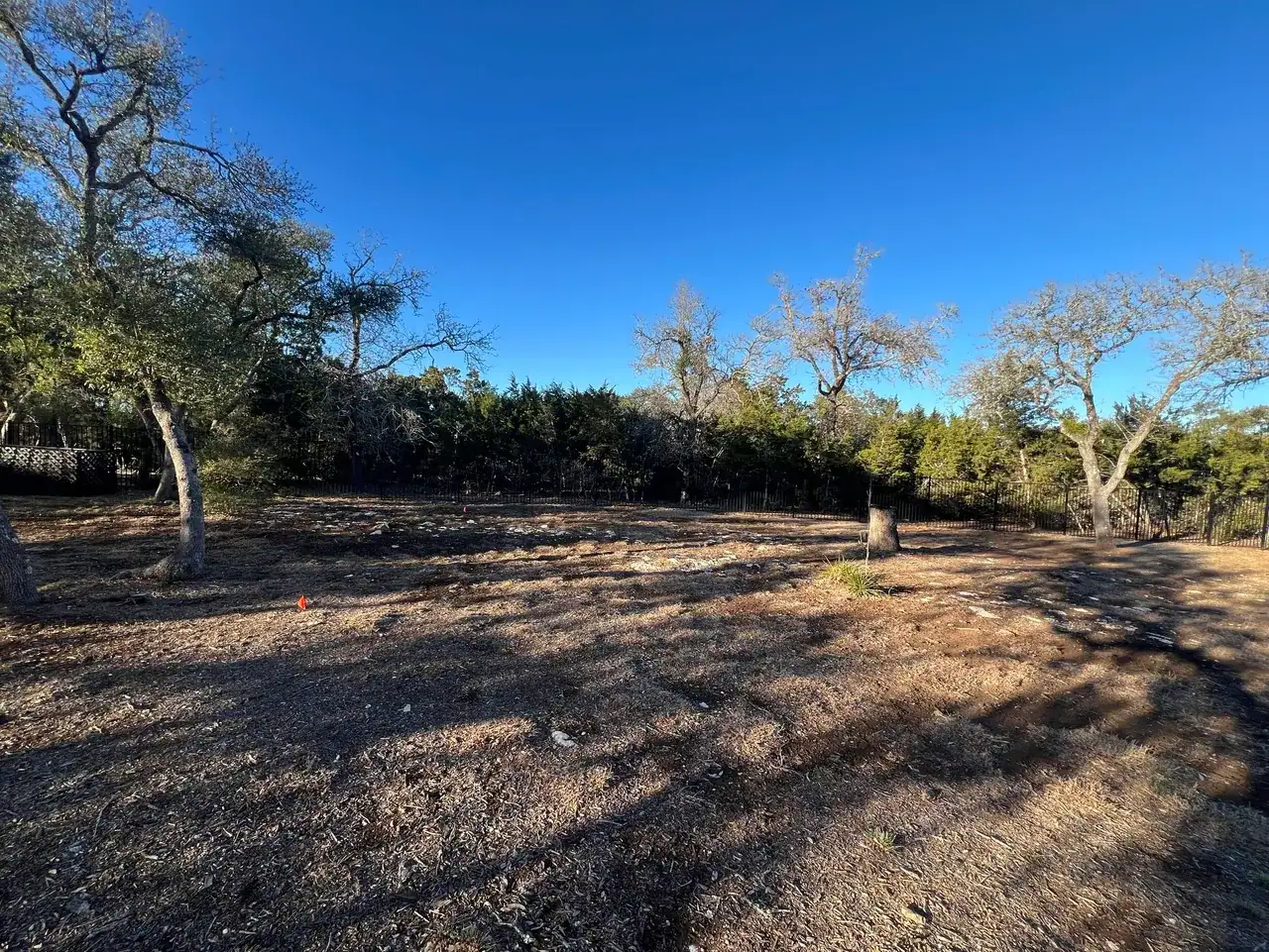

A builder lot walk is an early construction review of how a proposed home and the rest of the property may fit the land. The builder looks at visible access, usable building area, grade, drainage clues, utility routes, wastewater space, clearing, staging, orientation, and future structures. The useful result is not a promise that the lot is buildable. It is a written list of observations, unknowns, and next investigations.
A lot walk does not replace a survey, title review, topographic information, geotechnical work, engineering, flood review, wastewater evaluation, well or utility confirmation, design, permitting review, or legal advice. It helps the owner decide where those formal answers need to focus before the house plan and land purchase depend on assumptions.
Prepare the property and project information
A builder can offer a more useful review when the property is more than a map pin. Send the street address, parcel information, listing, and any documents already available. A current survey or recorded plat may show boundaries, access, easements, building lines, and other recorded information. Topographic information can make slope and drainage questions more specific.
Also describe the full project, even if it is still rough. Include the approximate home, number of levels, garage, porches, pool, casita, barn, shop, RV or trailer needs, outdoor living, yard, and possible future phases. The home may fit while the complete property does not.
Useful information to gather before the walk includes:
- The listing, address, parcel identification, or legal description
- A survey, plat, title documents, and private restrictions if available
- Topographic or flood information supplied by the seller or agent
- Known water, wastewater, electric, well, septic, propane, and communication information
- A simple project list with current and future buildings and outdoor features
- Priorities such as views, privacy, tree preservation, a level yard, accessibility, or workshop access
Incomplete information is normal. Mark what is confirmed, what came from the seller, and what remains an assumption. That distinction keeps a convenient note from becoming an unsupported design decision.
Walk access before choosing the building area
Start at the public road and follow the likely route into the property. A passenger vehicle reaching a clearing does not show whether concrete trucks, delivery vehicles, equipment, dumpsters, emergency access, and regular household traffic can use the same path. Gate width, culverts, turns, grade changes, low crossings, overhead branches, utility lines, and turnaround space can all shape the driveway and construction plan.
Notice whether the apparent access is legal and whether it crosses another parcel, easement, drainage area, or private road. The builder can flag the question. Survey, title, authority, and legal review need to establish the actual rights and requirements.
At the likely building area, compare total acreage with usable area. The working plan needs room for the home, garage, porches, driveway, parking, utilities, wastewater components, drainage work, outdoor areas, detached structures, and construction activity. Setbacks, easements, restrictions, flood information, slopes, trees, and infrastructure can reduce or divide the area that looked open on an aerial image.
Sketch more than one possible home position. A modest shift or rotation may change the driveway length, grading, views, afternoon exposure, utility routes, privacy, and relationship to future buildings. Early alternatives are easier to study than a fixed floor plan placed on the land after design.
Read grade, drainage, rock, and clearing as clues
A dry walk cannot show how the property behaves during a storm, and surface rock cannot establish subsurface conditions. The builder can still record visible clues. Channels, washed areas, sediment, debris lines, low crossings, standing water, exposed rock, disturbed soil, fill, retaining conditions, leaning fences, and neighboring runoff can point to questions for survey, engineering, drainage, or geotechnical review.
Follow the apparent direction of water into, across, and away from the site. Consider the likely home, driveway, patios, walls, pool, and roof drainage together. A grading idea that protects one area should not be assumed to work until the full property drainage is understood.
Trees and vegetation also affect placement and construction access. Record major trees, dense clearing, root zones, dead or damaged growth, and areas where equipment would need to move. A builder can discuss construction implications, while qualified arboricultural, environmental, design, and authority review should address tree condition and any applicable requirements.
Photograph important conditions and note the direction of each photo. Wide images help preserve the relationship among the road, grade, trees, drainage, and building area. Close images help document a particular crossing, outcrop, utility marker, or disturbed area.
Map wastewater, water, power, and communications
On property without public wastewater service, the site plan needs an appropriate area for the system, access, setbacks, and the intended use of the home and supporting buildings. A builder can look for obvious conflicts among the home, driveway, pool, well, drainage, trees, and future structures. The applicable authority and qualified wastewater professionals determine the property-specific evaluation, design, and approval path.
Do not assume that a neighboring system proves the same approach will work on this lot. Parcel conditions, home use, available area, and current requirements may differ.
Identify where public water, a private well, electric service, propane where used, and communications might reach the building area. Distance matters, but the route can matter just as much. Rock, roads, creeks, easements, walls, grade changes, and the final home position may complicate a short straight-line distance.
A nearby line, transformer, meter, utility box, or well does not confirm capacity, service rights, cost, quality, or approval. Record provider names and visible facilities, then seek written information from the responsible providers and professionals. The builder can use those answers to coordinate construction scope once they are available.
Test orientation, outdoor use, and construction staging
The highest point or center of a tract is not automatically the best home location. Compare views with afternoon sun, weather exposure, neighboring homes, road visibility, tree cover, yard needs, privacy, and the route to outdoor spaces. Walk the likely porch, kitchen, primary bedroom, garage, and arrival areas rather than judging the site from one scenic point.
Place the pool, casita, shop, barn, guest parking, play area, garden, walls, and future phases on the same sketch. A feature planned for later may occupy the only practical utility corridor or equipment route. Reserving an area now does not require it to be built, but it keeps the first phase from closing every option.
Then ask whether the home can actually be built in the proposed location. Crews need temporary access, material storage, equipment movement, parking, dumpsters, utilities, and room for earthwork and spoil. A finished home may fit within a tight area while the construction process does not.
Limited staging does not make a lot unsuitable by itself. It may affect delivery size, handling, protection, sequencing, and schedule. Those consequences should be visible before the plan and budget are treated as settled.
Separate observations from formal answers
A responsible lot-walk record distinguishes what was seen, what was inferred, and what requires confirmation. Boundaries, easements, title matters, elevations, drainage design, flood determinations, subsurface conditions, foundation recommendations, wastewater suitability, well performance, utility commitments, building requirements, and a final construction price do not come from a visual builder walk.
After the visit, organize the notes into three groups:
- Appears straightforward: Visible conditions that do not currently raise a major construction question, subject to later documents and review
- Needs a formal answer: Items for a surveyor, engineer, authority, provider, wastewater professional, well professional, title company, designer, or other qualified party
- Could redirect the project: Conditions that may change home placement, access, utilities, site work, supporting structures, cost, or schedule
Assign each open question to a responsible party and identify when the answer is needed. Questions that could change a land purchase or building area belong earlier than finish and floor-plan decisions.
Turn the record into next actions
A useful lot walk ends with more than photos. It should leave the owner with a preliminary property sketch, a list of visible conditions, a list of missing documents, and the names of the providers, authorities, or professionals who need to answer the next questions.
Before relying on the visit, confirm the exact parcel and legal access, obtain the available survey and restrictions, verify utility and wastewater paths, study topography and drainage, test the full property program, and document the likely construction route. If the property is under contract, coordinate these steps with the owner's real estate and legal advisers within the actual agreement and deadlines.
The next useful step is to compare the lot-walk notes with the broader Hill Country land due-diligence guide and turn every unresolved item into a named action rather than another assumption.