
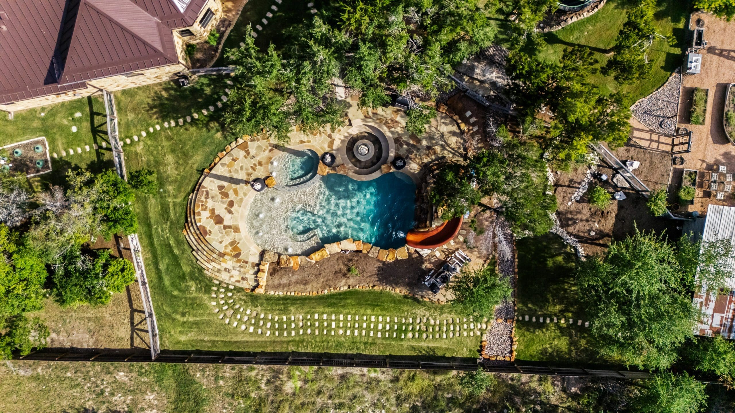
Drainage, grading, and slope are some of the most underestimated factors when building a home in the Texas Hill Country. Every experienced builder in this region has at least one story about a homeowner who fell in love with a beautiful hillside lot, skipped the site evaluation, and later discovered that managing water on that property was going to cost far more than expected. The Hill Country’s terrain is part of what makes it extraordinary — but it requires a thoughtful approach from the very first stake in the ground. Here’s what you need to know about drainage, grading, and slope when building your Hill Country home.
Why Hill Country Terrain Is Uniquely Challenging
The Central Texas Hill Country isn’t just gently rolling farmland. It’s a landscape carved by thousands of years of flash flooding, tectonic activity, and erosion. What you get is dramatic: limestone outcroppings, cedar-covered ridgelines, creek drainages, and hillsides with 10–30% grades or steeper in some areas.
These conditions create real engineering challenges for builders:
- Rocky substrate: Solid limestone requires blasting or specialized rock excavation equipment. It’s slow and expensive compared to standard soil excavation.
- Thin topsoil: In many areas, there’s barely two to six inches of topsoil over solid rock. This affects landscaping, drainage system design, and septic feasibility.
- Flash flood risk: The Hill Country sits in “Flash Flood Alley.” Drainage design must account for heavy rainfall events — not just average rain, but the 10-inch, 24-hour storms that hit this region every few years.
- Variable soil composition: Some areas have deep clay soils prone to expansion and contraction. Others are pure limestone. The soil type dramatically affects foundation design and drainage performance.
Before making an offer on a property, it’s worth reading our guide to buying land in the Texas Hill Country, which covers topography and flood zone evaluation in the pre-purchase stage.
Site Evaluation: Reading the Land Before You Build
A thorough site evaluation is the foundation of good drainage and grading design. Before any construction planning begins, your builder and civil engineer should conduct a detailed assessment of:
- Natural drainage patterns: Where does water flow on the property? Are there any defined swales, seasonal drainage channels, or low points where water collects?
- Slope analysis: What percentage grade exists across the buildable area? Are there areas of concentrated slope that would require special treatment?
- FEMA flood zone designation: Is any part of the property in a designated flood plain? What is the base flood elevation?
- Soil composition and depth: A geotechnical report will identify soil layers, rock depths, bearing capacity, and expansion potential.
- Neighboring drainage contributions: Does water from adjacent properties flow onto your lot? Uphill neighbors’ runoff becomes your problem if not properly managed.
This information directly informs the site plan, which establishes the home’s placement, pad elevation, driveway routing, and drainage infrastructure. A good site plan can save tens of thousands of dollars; a poor one can cost that much in remediation after the fact.
Cut-and-Fill: Shaping the Site to Work With Your Plans
On sloped terrain, builders use a technique called cut-and-fill to create a level building pad. The high side of the slope is cut back, and that material is moved (filled) to build up the low side. When done correctly, the cut balances the fill and you don’t need to haul in or haul away large amounts of soil.
What Drives Cut-and-Fill Costs
- Grade severity: A 5% slope requires minimal grading. A 25% slope requires substantial cut-and-fill work — and potentially a different approach entirely.
- Material: Moving soil is cheap. Moving rock is expensive. Limestone bedrock requires excavation equipment with hydraulic hammers or blasting permits.
- Volume: More cut-and-fill means more equipment time, more operator hours, and more cost. A modest hillside pad for a 3,000 sq. ft. home might run $15,000–$40,000 in grading and excavation. A more aggressive cut into steep terrain can push $60,000–$100,000+.
- Import or export of material: If the site doesn’t balance (you need more fill than you cut, or have excess cut material), trucking costs add up quickly. Each dump truck load of fill or haul-away can run $300–$600.
Retaining Walls: When You Need Them and What They Cost
On sloped lots, retaining walls are often necessary to create usable outdoor space, stabilize cut slopes, and manage drainage. They’re one of the most significant line items in Hill Country site development budgets.
Types of Retaining Walls
- Poured concrete: Strongest and most durable. Best for walls over four feet in height. Requires engineering for taller walls. Cost: $35–$80+ per square face foot.
- Concrete block (CMU): Common for mid-height walls. Requires rebar and fill. Cost: $25–$60 per square face foot.
- Segmental retaining wall (e.g., Allan Block): Gravity walls using interlocking blocks. Good for walls under four feet. Cost: $20–$45 per square face foot.
- Dry-stacked limestone: A traditional Hill Country aesthetic choice. Labor-intensive and requires skilled masons. Cost varies widely — $50–$150+ per square face foot for quality work.
For walls over four feet, most jurisdictions require engineer certification. Budget for that separately. And plan drainage behind every wall — a retaining wall without a drainage system will fail over time as hydrostatic pressure builds up.
Drainage Solutions: Managing Water on Your Property
The goal of a good drainage design is simple: move water away from the foundation and off the property in a controlled way, without causing erosion or flooding problems downstream. Achieving that goal on a sloped Hill Country lot takes real engineering.
Foundation Drainage
- The finish floor elevation of your home should sit several inches above the surrounding grade to prevent water intrusion.
- Positive drainage away from the foundation — minimum 6 inches of fall in the first 10 feet — should be designed into the grading plan, not assumed to happen naturally.
- French drains or surface channel drains may be needed to intercept uphill water before it reaches the building pad.
Driveway and Surface Drainage
- A steep driveway that runs straight downhill becomes a river in a heavy storm. Good driveway design incorporates cross-slopes and drainage channels to shed water before it concentrates.
- Bar ditches and swales along roads and driveways should have armored (rock-lined) sections in areas of concentrated flow to prevent erosion.
Detention and Retention
- Some counties and municipalities require stormwater detention on larger lots to ensure that development doesn’t increase the rate of runoff to neighboring properties or public drainage systems.
- A simple detention pond or dry swale can provide this function while also adding landscape character to the property.
Proper drainage planning integrates closely with your septic system placement — certain setback requirements between drain fields and drainage features must be maintained. For more on how septic planning fits into site prep, see our post on septic, well water, and utilities for acreage builds.
Foundation Types for Sloped Lots
The foundation your home is built on is directly tied to the site conditions, and sloped lots in the Hill Country often require something other than a standard slab-on-grade.
- Slab-on-grade: Works on reasonably flat sites with suitable soils or rock. Requires adequate grading and drainage around the perimeter.
- Post-tension slab: Common in Central Texas where expansive soils are present. Engineered cable system controls cracking as soils move. More expensive than standard slab but often required by soil reports.
- Pier and beam: Used on sites with significant slope or problematic soils. The home is elevated above grade on piers drilled into bedrock or stable soil. More expensive than slab construction but excellent for steep terrain and provides a crawlspace that can simplify mechanical access.
- Stepped slab: A slab that steps down with the natural slope of the site rather than requiring massive fill to create a level platform. Can reduce fill requirements on moderately sloped sites.
Foundation selection should be based on a geotechnical engineer’s recommendation for your specific site. Don’t let anyone design your foundation without a soil report in hand.
Cost Implications of Challenging Terrain
Here’s the bottom line on Hill Country terrain and what it means for your budget:
- A flat, cleared lot in a developed subdivision: minimal site prep costs. Budget $10,000–$20,000 for grading, drainage, and erosion controls.
- A gently sloped lot with good soils: moderate site prep. Budget $20,000–$50,000.
- A steep rocky hillside lot with elevation changes: significant site prep. Budget $50,000–$120,000+ depending on scope of retaining walls, rock excavation, and drainage infrastructure.
These aren’t numbers builders like to talk about in the sales process — but they’re real, and they dramatically affect your total project cost. Knowing the terrain of your property before you finalize your budget is essential. The best time to get ahead of this is during the land evaluation phase, before purchase, which is why bringing your builder into the land search pays dividends.
Frequently Asked Questions: Drainage, Grading, and Slope in the Hill Country
How do I know if my lot has a drainage problem before I buy it?
Walk the property after a rain if at all possible. Look for signs of erosion, standing water, or concentrated flow across the buildable area. Check FEMA flood maps. Hire a civil engineer or walk the lot with an experienced local builder before you commit. Asking neighbors about drainage patterns is also valuable — they often have years of first-hand experience with how water moves on adjacent properties.
Do I need a civil engineer for site grading on a custom home?
For most custom homes in the Hill Country, yes — particularly in jurisdictions that require stamped drainage plans. Even where an engineer isn’t required by code, the cost of a civil engineer’s drainage and grading design is almost always worth it. Poor drainage design is one of the most expensive problems to fix after the fact.
How steep is too steep to build on in the Texas Hill Country?
There’s no absolute maximum slope — homes have been built on extremely steep terrain with the right engineering. But as a practical matter, slopes above 15–20% start adding significant cost through rock excavation, retaining walls, engineered foundations, and specialized drainage. Above 25–30%, you’re looking at a project that requires significant engineering investment and where the site prep costs alone can rival the cost of the home structure.
What is a retaining wall drainage system and why does it matter?
A retaining wall drainage system — typically a combination of gravel backfill, a perforated drain pipe (French drain), and outlet weep holes — relieves the hydrostatic pressure that builds up behind a wall when the soil becomes saturated. Without drainage, that pressure will eventually push even well-built walls out of alignment or cause catastrophic failure. Every retaining wall should have a drainage system designed into it from the beginning.
Can I build a standard slab foundation on a sloped Hill Country lot?
Sometimes, depending on the degree of slope and soil conditions. A stepped slab can work on moderately sloped sites. On steeper terrain, a pier-and-beam foundation is usually a better engineering solution because it follows the natural topography rather than fighting it with fill. Your geotechnical engineer will identify which foundation types are appropriate for your specific site conditions.
Does grading and drainage work affect my landscaping plans?
Absolutely — and it should be coordinated from the beginning. Your drainage plan affects where you can place lawns, garden beds, pools, and hardscape. The good news is that thoughtfully designed drainage elements — rock-lined swales, dry creek beds, limestone retaining terraces — are also beautiful landscape features when done well in the Hill Country aesthetic. Plan drainage as part of your landscape design from the start, not as an afterthought.
Ready to Start Your Project?
At Ridge Rock Builders, we specialize in custom homes, remodels, barns, shops, and casitas throughout the Texas Hill Country. Whether you’re still exploring your options or ready to break ground, we’d love to talk.
Get a free build estimate or call us at (512) 294-9579 to start the conversation.